Filter
479
Featured
87
158
Language
Document type
223
52
42
31
28
21
21
16
15
11
10
4
4
1
Countries
47
42
38
22
18
14
12
11
11
11
10
9
8
8
8
7
7
7
7
7
6
5
5
5
5
3
3
3
3
3
3
3
3
3
2
2
2
2
2
2
2
1
1
1
1
1
1
1
1
1
1
1
1
1
1
1
1
1
1
1
1
1
1
1
1
1
1
1
1
1
1
Authors & Publishers
Publication Years
Category
169
120
28
19
8
7
4
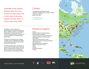
Global Health, Local Information.
The freely available Web site 'healthmap.org' and mobile app 'Outbreaks Near Me' deliver real-time intelligence on a broad range of emerging infectious diseases for a diverse audience including libraries, local health departments, governments, and international tra
...
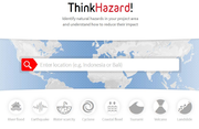
As an online disaster risk visualization tool, ThinkHazard! aims to provide users with information to make risk-informed choices. This is the first platform of its kind, allowing anyone to quickly find information on 8 different types of hazards in their search area. All information is open source a
...
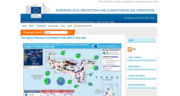
The Emergency Response Coordination Centre (ERCC) Portal of the European Civil Protection and Humanitarian Aid Operations includes Daily Maps, Base maps, Satellite Maps and Situation Maps.
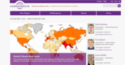
The Climate Risk Index (CRI) ranks countries by the human and economic toll of extreme weather. The latest edition highlights increasing losses and the urgent need for stronger climate resilience and action.
The compendium compiles practical case studies on the use of Geospatial Artificial Intelligence (GeoAI) to enhance disaster risk reduction and emergency response across diverse geographic and institutional contexts.
The compendium features selected case studies submitted by twenty-seven Regional Su
...
PreventionWeb, the global knowledge-sharing platform for disaster risk reduction and resilience
This document is designed to assist UNICEF and WHO country offices in collaborating with national, sub-national, and
local counterparts to implement the UNICEF Game Plan to Reach Safely Managed Sanitation 2022–2030 and the WHO
Guidelines on sanitation and health. It also aims to facilitate compl
...

With an estimated population of about 5 million and an annual growth rate of 8 per cent, Dar es Salaam, Tanzania, is Africa’s fastest growing city.1 Over 70 per cent of the people live in informal, unplanned settlements with inadequate infrastructure. In addition, heavy rainfalls twice a year
...
Flood mapping in urban areas poses significant challenges for Synthetic Aperture Radar (SAR) sensors due to limitations in detecting water in regions characterized by dense vegetation, urban infrastructure, or complex surface conditions. These limitations include reduced sensitivity in vegetated or
...
Epi Info™ is a public domain suite of interoperable software tools designed for the global community of public health practitioners and researchers. It provides for easy data entry form and database construction, a customized data entry experience, and data analyses with epidemiologic statistics,
...
The ERF provides WHO staff with essential guidance on how the Organization manages the assessment, grading and response to public health events and emergencies with health consequences, in support of Member States and affected communities. The ERF adopts an all-hazards approach and it is therefore a
...
En esta nota técnica se explican los 20 aspectos que deben considerarse para evaluar el estado y la seguridad del equipo y los suministros de laboratorio. No se incluyen en este trabajo las instrucciones para los evaluadores de los puntos 93 (Estado y seguridad del equipo médico en las salas de op
...
The Haiti Earthquake and Cholera Emergency appeal (MDRHT018) was implemented by the International Federation of Red Cross and Red Crescent Societies (IFRC) in collaboration with the Haitian Red Cross Society (HRCS) following the devastating earthquake on 14 August 2021, and the cholera outbreak on 2
...
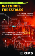
En esta sección vinculada al fenómeno climático de incendios forestales se puede acceder a las principales recomendaciones sobre: ¿qué hacer frente a un evento de contaminación del aire? y ¿qué hacer en zonas de incendios forestales?
UThe UNDAC Handbook is intended as an easily accessible reference guide for members of an UNDAC team before and during a mission to a disaster or emergency. The Handbook is not an authoritative instruction, but rather represents an accumulation of institutional memory related to processes and proced
...

This information can be used to assess the extent of the damage and the needs of affected communities. Information should be gathered on the extent of damage to infrastructure, housing, and public facilities such as hospitals, schools, and water systems. This information can be used to prioritize th
...
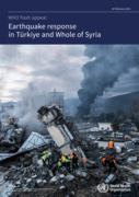
A 7.7 magnitude earthquake struck at 04:17 local time on 6 February 2023, with its epicentre located in Pazarcık district
in Kahramanmaraş province, Türkiye. Over 1200 aftershocks have since been reported. These are Türkiye’ s most powerful
earthquakes since 1939
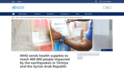
In response to the devastating earthquakes impacting Türkiye and the Syrian Arab Republic, the World Health Organization delivered 72 metric tons of trauma and emergency surgery supplies, including treatments, to both countries to support ongoing response efforts.
A first charter flight depar
...
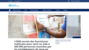
À la suite des tremblements de terre dévastateurs qui ont frappé la Türkiye et la République arabe syrienne, l’Organisation mondiale de la Santé a livré 72 tonnes de fournitures pour des soins de traumatologie et de chirurgie d’urgence, y compris des traitements, afin de soutenir les opé
...
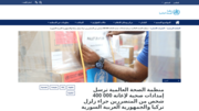
ستجابةً للهزات الأرضية المدمرة التي ضربت تركيا والجمهورية العربية السورية، أرسلت منظمة الصحة العالمية إلى البلدين المنكوبين 72 طناً مترياً من الإمدادات اللازمة لم�
...