Filter
1820
Text search:
geographic
information
systems
Featured
162
602
Language
1794
38
29
18
14
13
11
3
3
2
2
2
2
2
2
1
1
1
1
1
1
1
1
1
1
1
1
1
1
1
1
1
1
1
1
Document type
956
360
238
101
101
26
22
9
4
1
1
1
Countries
99
54
52
49
46
44
40
39
37
37
34
33
32
31
31
27
27
26
25
24
20
17
17
17
16
14
14
13
13
12
12
12
11
11
11
11
10
10
9
9
8
7
7
7
6
6
6
6
5
4
4
4
4
4
4
3
3
3
3
3
3
3
3
3
3
3
3
2
2
2
2
2
2
2
2
2
2
2
2
2
1
1
1
1
1
1
1
1
1
1
1
1
1
1
1
1
1
1
1
1
1
1
1
Authors & Publishers
228
54
49
43
39
39
35
23
19
17
11
11
11
11
10
9
9
9
9
8
8
8
8
8
7
7
7
7
6
6
6
6
6
6
6
6
6
6
6
5
5
5
5
5
5
5
5
5
5
5
5
5
5
5
4
4
4
4
4
4
4
4
4
4
4
4
4
4
4
4
4
4
4
3
3
3
3
3
3
3
3
3
3
3
3
3
3
3
3
3
3
3
3
3
3
3
3
3
3
3
3
3
3
3
3
3
3
3
3
3
3
3
3
3
3
2
2
2
2
2
2
2
2
2
2
2
2
2
2
2
2
2
2
2
2
2
2
2
2
2
2
2
2
2
2
2
2
2
2
2
2
2
2
2
2
2
2
2
2
2
2
2
2
2
2
2
2
2
2
2
2
2
2
2
2
2
2
2
2
2
2
2
2
2
2
2
2
2
2
2
2
2
2
2
2
2
2
2
2
2
2
2
2
2
2
2
2
2
2
2
2
2
2
2
2
2
2
2
2
2
2
2
2
2
2
2
2
2
2
1
1
1
1
1
1
1
1
1
1
1
1
1
1
1
1
1
1
1
1
1
1
1
1
1
1
1
1
1
1
1
1
1
1
1
1
1
1
1
1
1
1
1
1
1
1
1
1
1
1
1
1
1
1
1
1
1
1
1
1
1
1
1
1
1
1
1
1
1
1
1
1
1
1
1
1
1
1
1
1
1
1
1
1
1
1
1
1
1
1
1
1
1
1
1
1
1
1
1
1
1
1
1
1
1
1
1
1
1
1
1
1
1
1
1
1
1
1
1
1
1
1
1
1
1
1
1
1
1
1
1
1
1
1
1
1
1
1
1
1
1
1
1
1
1
1
1
1
1
1
1
1
1
1
1
1
1
1
1
1
1
1
1
1
1
1
1
1
1
1
1
1
1
1
1
1
1
1
1
1
1
1
1
1
1
1
1
1
1
1
1
1
1
1
1
1
1
1
1
1
1
1
1
1
1
1
1
1
1
1
1
1
1
1
1
1
1
1
1
1
1
1
1
1
1
1
1
1
1
1
1
1
1
1
1
1
1
1
1
1
1
1
1
1
1
1
1
1
1
1
1
1
1
1
1
1
1
1
1
1
1
1
1
1
1
1
1
1
1
1
1
1
1
1
1
1
1
1
1
1
1
1
1
1
1
1
1
1
1
1
1
1
1
1
1
1
1
1
1
1
1
1
1
1
1
1
1
1
1
1
1
1
1
1
1
1
1
1
1
1
1
1
1
1
1
1
1
1
1
1
1
1
1
1
1
1
1
1
1
1
1
1
1
1
1
1
1
1
1
1
1
1
1
1
1
1
1
1
1
1
1
1
1
1
1
1
1
1
1
1
1
1
1
1
1
1
1
1
1
1
1
1
1
1
1
1
1
1
1
1
1
1
1
1
1
1
1
1
1
1
1
1
1
1
1
1
1
1
1
1
1
1
1
1
1
1
1
1
1
1
1
1
1
1
1
1
1
1
1
1
1
1
1
1
1
1
1
1
1
1
1
1
1
1
1
1
1
1
1
1
1
1
1
1
1
1
1
1
1
1
1
1
1
1
1
1
1
1
1
1
1
1
1
1
1
1
1
1
1
1
1
1
1
1
1
1
1
1
1
1
1
1
1
1
1
1
1
1
1
1
1
1
1
1
1
1
1
1
1
1
1
1
1
1
1
1
1
1
1
1
1
1
1
1
1
1
1
1
1
1
1
1
1
1
1
1
1
1
1
1
1
1
1
1
1
1
1
1
1
1
1
1
1
1
1
1
1
1
1
1
1
1
1
1
1
1
1
1
1
1
1
1
1
1
1
1
1
1
1
1
1
1
1
1
1
1
1
1
1
1
1
1
1
1
1
1
1
1
1
1
1
1
1
1
1
1
1
1
1
1
1
1
1
1
1
1
1
1
1
1
1
1
1
1
1
1
1
1
1
1
1
1
1
1
1
1
1
1
1
1
1
1
1
1
1
1
1
1
1
1
1
1
1
1
1
1
1
1
1
1
1
1
1
1
1
1
1
1
1
1
1
1
1
1
1
1
1
1
1
1
1
1
1
1
1
1
1
1
1
1
1
1
1
1
1
1
1
1
1
1
1
1
1
1
1
1
1
1
1
1
1
1
1
1
1
1
1
1
1
1
1
1
1
1
1
1
1
1
1
1
1
1
1
1
1
1
1
1
1
1
1
1
1
1
1
1
1
1
1
1
1
1
1
1
1
1
1
1
1
1
1
1
1
1
1
1
1
1
1
1
1
1
1
1
1
1
1
1
1
1
1
1
1
1
1
1
1
1
1
1
1
1
1
1
1
1
1
1
1
1
1
1
1
1
1
1
1
1
1
1
1
1
1
1
1
1
1
1
1
1
1
1
1
1
1
1
1
1
1
1
1
1
1
1
1
1
1
1
1
1
1
1
1
1
1
1
1
1
1
1
1
1
1
1
1
1
1
1
1
1
1
1
1
1
1
1
1
1
1
1
1
1
1
1
1
1
1
1
1
1
1
1
1
1
1
1
1
1
1
1
1
1
1
1
1
1
1
1
1
1
1
1
1
1
1
1
1
1
1
1
1
1
1
1
1
1
1
1
1
1
1
1
1
1
1
1
1
1
1
1
1
1
1
1
1
1
1
1
1
1
1
1
1
1
1
1
1
1
1
1
1
1
1
1
1
1
1
1
1
1
1
1
1
1
1
1
1
1
1
1
1
1
1
1
1
1
1
1
1
1
1
1
1
1
1
1
1
1
1
1
1
1
1
1
1
1
1
1
1
1
1
1
1
1
1
1
1
1
1
1
1
1
1
1
1
1
1
1
1
1
1
1
1
1
1
1
1
1
1
1
1
1
1
1
1
1
1
1
1
1
1
1
1
1
1
1
1
1
1
1
1
1
1
1
1
1
1
1
1
1
1
1
1
1
1
1
1
1
1
1
1
1
1
1
1
1
1
1
1
1
1
1
1
1
1
1
1
1
1
1
1
1
1
1
1
1
1
1
1
1
1
1
1
1
1
1
1
1
1
1
1
1
1
1
1
1
1
1
1
1
1
1
1
1
1
1
1
1
1
1
1
1
1
1
1
1
1
1
1
1
1
1
1
1
1
1
1
1
1
1
1
1
1
1
1
1
1
1
1
1
1
1
1
1
1
1
1
1
1
1
1
1
1
1
1
1
1
1
1
1
1
1
1
1
1
1
1
1
1
1
1
1
1
1
1
1
1
1
1
1
1
1
1
1
1
1
1
1
1
1
1
1
1
1
1
1
1
1
1
1
1
1
1
1
1
1
1
1
1
1
1
1
1
1
1
1
1
1
1
1
1
1
1
1
1
1
1
1
1
1
1
1
1
1
1
1
1
1
1
1
1
1
1
1
1
1
1
1
1
1
1
1
1
1
1
1
1
1
1
1
1
1
1
1
1
1
1
1
1
1
1
1
1
1
1
1
1
1
1
1
1
1
1
1
1
1
1
1
1
1
1
1
1
1
1
1
1
1
1
1
1
1
1
1
1
1
1
1
1
1
1
1
1
1
1
1
1
1
1
1
1
1
1
1
1
1
1
1
1
1
1
1
1
1
1
1
1
1
1
1
1
1
1
1
1
1
1
1
1
1
1
1
1
1
1
1
1
1
1
1
1
1
1
1
1
1
1
1
1
1
1
1
1
1
1
1
1
1
1
1
1
1
1
1
1
1
1
1
1
1
1
1
1
1
1
1
1
1
1
1
1
1
1
1
1
1
1
1
1
1
1
1
1
Publication Years
566
1122
121
11
Category
740
186
115
112
98
23
14
Toolboxes
127
121
75
68
66
53
51
50
50
46
46
43
42
39
33
30
27
26
25
23
19
19
16
13
4
3
1
This guide is an introduction on how to integrate logistics management information systems (LMIS) with geographic
...
information systems (GIS). It covers the value of integrating these two systems, the steps in assessing if it is currently viable to link the systems, how to set the linkage, the processes for using LMIS within a GIS platform, and finally how to sustain the linkage. The aim of this guide is to assist logistics managers, decisionmakers and technical experts in understanding the value of integrating GIS and of the process involved in integrating these two systems.
more
The Rural Emergency Preparedness and Response Toolkit provides a comprehensive overview of how rural and tribal communities can prepare for, respond to, and recover from emergencies and disasters. It explains the unique challenges rural areas face—such as limited resources,
...
geographic isolation, and vulnerable populations—and offers evidence-based strategies, best practices, and real-world examples to strengthen local preparedness. The toolkit outlines key components of emergency planning, coordinated response structures, and long-term recovery efforts, while also describing the types of emergencies rural communities are most likely to encounter, including natural disasters, disease outbreaks, and infrastructure failures. In addition, it highlights available funding opportunities, organizational tools, and capacity-building resources to support communities in developing resilient emergency systems and continuously improving their preparedness based on lessons learned.
more
This module carries pre-training entry level assessment as well as hands on exercise manual on Geographic Information Systems, Remote Sensing,
...
Geographic Positioning System (GPS) and some applications of these technologies on Disaster Risk Management (DRM) especially for hazard mapping, monitoring and risk assessment module as well as the damage assessment module. Practical manual developed using open source products like Quantum GIS , RStudio, Google Earth Pro and Google Earth Engine.
This module can also can be used by other training facilitators, non-technical professionals and selflearners as well. However, it is strongly recommended that training participants and self-learners already have some basic knowledge of Computer Basic, Geoinformatics and disaster management.
No publication year indicated.
Original file: 29,5 MB more
This module carries pre-training entry level assessment as well as hands on exercise manual on Geographic Information Systems, Remote Sensing,
...
Geographic Positioning System (GPS) and some applications of these technologies on Disaster Risk Management (DRM) especially for hazard mapping, monitoring and risk assessment module as well as the damage assessment module. Practical manual developed using open source products like Quantum GIS , RStudio, Google Earth Pro and Google Earth Engine.
This module can also can be used by other training facilitators, non-technical professionals and selflearners as well. However, it is strongly recommended that training participants and self-learners already have some basic knowledge of Computer Basic, Geoinformatics and disaster management.
No publication year indicated.
Original file: 30,5 MB more
The Capacity Project worked to strengthen HRIS in several low-resource countries to assist decision-makers and human resources managers in identifying and responding to critical gaps in HRH. The findings and recommendations in this report cover the Capacity Project’s implementation of HRIS in Swaz
...
iland, Rwanda and Uganda.
more
This guide includes information relevant for tuberculosis (TB) program and laboratory managers, as well as Ministry of Health officials across disease programs interested in establishing integrated solutions for specimen referral. Though TB-focused
...
in name, it offers integration-oriented assessment, design, and monitoring guidance related to improving coordination and efficiency, and is relevant for other programs as well. Country case studies include viral load and early infant diagnosis (EID) in Uganda and EID in Ethiopia.
more
Access to health workers who are fit for purpose, motivated and protected is a fundamental force of health service delivery and the achievement of universal health coverage and the health and health-related Sustainable Development Goals. Data and knowledge of the distribution, skill mix and future d
...
evelopment needs of the health workforce can mean the difference between enabling or impeding health systems performance, inclusive economic growth and global health security preparedness and response
more
31 Janaury 2021
SCORE for health data technical package. The first global assessment on the status and capacity of health information systems in 133 countries, covering 87% of the global population
...
.
It identifies gaps and provides guidance for investment in areas that can have the greatest impact on the quality, availability, analysis, accessibility and use of health data.
more
The document “Strategic Framework for Strengthening Cross-Border Surveillance and Information Sharing in Africa” outlines a coordinated strategy developed by Africa CDC to improve public health surveillance and collaboration across national bord
...
ers in Africa. It addresses the challenge that infectious diseases often spread across borders due to population movement, trade, and migration, while surveillance systems and data-sharing mechanisms frequently remain nationally focused and fragmented.
The framework proposes strengthening regional coordination, harmonizing surveillance systems, enhancing information sharing between countries, and building laboratory and workforce capacity. It also emphasizes timely detection of cross-border health threats, joint outbreak investigations, and improved communication among Member States. Overall, the document aims to enhance preparedness, early warning systems, and collective response to public health threats across the African continent.
more
his publication addresses surveillance and outbreak management of WRID associated with drinking-water supply systems, building on existing guidelines for infectious disease surveillance and outbreak response. It aims to help countries to build on an
...
d strengthen their systems by providing technical information on the specific features, activities and methodologies related to WRID surveillance and outbreak management.
more
The report presents the latest data on more than 50 health-related Sustainable Development Goal and "triple billion" target indicators. The 2021 edition includes preliminary estimates for global excess deaths attributable to COVID-19 for 2020 and the state of global and regional health trends from 2
...
000-2019. It also focuses on persistent health inequalities and data gaps that have been accentuated by the pandemic, with a call to urgently invest in health information systems to ensure the world is better prepared with better data.
more
For the 24th consecutive year, PAHO has published the report Health Situation in the Americas: Core Indicators featuring the latest information on key indicators for the Region of the Americas. This 2018 edition includes data on the 82 core indicato
...
rs for the countries, territories, and sub regions of the Americas, grouped into the following categories: demographic-socioeconomic, health status, risk factors, service coverage, and health systems. Information is also presented on 22 indicators of the Sustainable Development Goals (SDGs).
more
The Relationship between the Health Service Environment and Service Utilization: Linking Population Data to Health Facilities Data in Haiti and Malawi.
Wenjuan Wang, Rebecca Winter, Lindsay Mallick, Lia Florey, Clara Burgert-Brucker, and Emily Carter
ICF International
(2015)
C2
DHS Analytical Studies No. 51
Child Health, Family Planning, Geographic Information, HIV, Malaria, Maternal Health
A nationwide survey of a representative sample of health facilities across public health services in all states and regions of Myanmar has been undertaken since 2014 to track Reproductive Health Commodity Security (RHCS) indicators, such as the availability of reproductive health (RH) commodities; t
...
he supply chain (including cold chain systems); staff training and supervision; availability of guidelines and protocols; information and communication technologies; methods of waste disposal; and user fees. The surveys have also obtained the views of clients about the quality and cost of services through exit interviews. This is the third report for Myanmar, which is an assessment of the situation in 2016.
more
The package is designed to help address the WASH in Schools monitoring deficit at the national level.
The package consists of three modules:
The EMIS module: a set of basic monitoring questions on WASH in Schools to be incorporated into national Education Monitoring ... Information Systems (EMIS), usually administered annually;
The survey module: a more comprehensive set of questions, observations and focus group discussion guidelines for use in national WASH in Schools surveys as well as for sub-national, project level or thematic surveys;
The children’s monitoring module: a teacher’s guide and tool set for the monitoring of WASH in Schools by students, including observation checklists, survey questions and special monitoring exercises. more
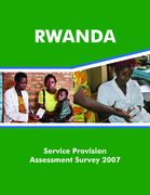
The 2007 Rwanda Service Provision Assessment (RSPA) was a national representative survey conducted in 538 health facilities throughout Rwanda. The survey covered hospitals, health centers, dispensaries and
health posts, including all public facilities such as government and government-assisted heal
...
th facilities. The 2007 RSPA used interviews with health service providers and clients and observations of provider client consultations to obtain information on the capacity of facilities to provide quality services and the existence of functioning systems to support quality services. The areas addressed were the overall facility
infrastructure, maternal and child health, reproductive health, tuberculosis, malaria services; and services for sexually transmitted infections and HIV/AIDS. The objective was to assess the strengths and
weaknesses of the infrastructure and systems supporting these services, and to assess the adherence to standards in the delivery of services.
more
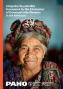
The objective of this concept note and the framework it outlines is the elimination of a group of CDs and the negative health effects they generate, which together create a tangible burden on affected individuals, their families and communities, and on health care
...
systems throughout the Region. Though there is no unified consensus on the best measures to use for the public’s health and a nation’s epidemiologic situation, it is common for the disease burden to be measured by disease rates (incidence, prevalence, etc.), disease-specific death rates, comparative morbidity and mortality rates, geographic distribution, and disability-adjusted life years (DALYs). The current epidemiological situation, including data on disease rates or geographic distribution for the diseases in Table 1, is discussed below in Section 4. Hotez et al. (2008) were the first to review and compare the burden of DALYs in Latin America and the Caribbean—for NTDs, HIV/AIDS, malaria, and TB—as it existed about 10 years ago. Though the regional burden of TB, malaria, and neglected infectious diseases (NIDs) is somewhat less than it was 10 years ago, work (and schooling) continue to be lost to illness and premature death or disability, and the need for stepping up disease elimination efforts is evident in all communities living in vulnerable conditions....
more
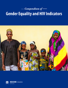
The intended purpose of this compendium is to provide program managers, organizations, and policy makers with a menu of indicators to better “know their HIV epidemic/know their response” from a gender perspective. The indicators in the compendium are all either part of existing indicators used i
...
n studies or by countries or have been adapted from existing indicators to address the intersection of gender and HIV. The indicators can be measured through existing data collection and information systems (e.g. routine program monitoring, surveys) in most country contexts, though some may require special studies or research.
more
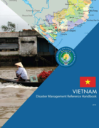
The National Strategy for Natural Disaster, Prevention, Response and Mitigation to 2020, which outlines Vietnam’s main disaster risk management objectives and the National Target Program (NTP) form the overarching policy framework for disaster risk management and climate change adaption activities
...
. The CCFSC’s main mandate is to translate this strategy into action. Other decrees and laws are also complementary. The Government of Vietnam has prioritized disaster preparedness, recognizing that the most cost-effective measures to mitigate flood related disasters are often non-structural. These measures include flood mapping, river flood warning systems, television-based disaster information and warning systems, training at all government and grassroots levels on disaster preparedness, and reforestation of certain areas. Land use and development have also been addressed through government regulations.
more