Filter
606
Filtered Results: 606
Text search:
Bambo
Featured
Recommendations
42
New Publications
173
Language
Document type
No document type
389
Studies & Reports
90
Guidelines
50
Manuals
34
Strategic & Response Plan
11
Brochures
8
Situation Updates
8
Fact sheets
8
Training Material
4
Infographics
3
Resource Platforms
1
Countries / Regions
Indonesia
67
Myanmar / Burma
36
Central African Republic
35
Bangladesh
30
Congo, Democratic Republic of
20
India
16
Nepal
14
Global
14
Liberia
14
Sierra Leone
13
Germany
11
Philippines
10
Western and Central Europe
10
Latin America and the Carribbean
9
Burkina Faso
8
Kenya
7
Guinea
7
Mozambique
7
South Africa
7
Uganda
7
Malawi
6
Africa
6
Ethiopia
6
South Sudan
6
Nigeria
5
Mali
5
Ukraine
4
Ghana
4
Benin
4
Senegal
4
Cambodia
4
Tanzania
4
Eastern Europe
4
Russia
4
Zambia
4
Colombia
3
Afghanistan
3
Peru
3
West and Central Africa
3
Bolivia
3
Angola
3
China
2
Rwanda
2
Cameroon
2
Syria
2
Laos
2
Haiti
2
Asia
2
Venezuela
2
South–East Asia Region
2
Vietnam
2
Brazil
2
Eswatini/ Swaziland
2
Pakistan
2
North Macedonia
1
Tajikistan
1
Timor Leste/ East Timor
1
Thailand
1
Mexico
1
Serbia
1
Kazakhstan
1
Kyrgyzstan
1
Burundi
1
Armenia
1
USA
1
Guinea-Bissau
1
East and Southern Africa
1
Namibia
1
Yemen
1
Palestine
1
Libya
1
Botswana
1
Iraq
1
Somalia
1
Ecuador
1
Madagascar
1
Authors & Publishers
Publication Years
Category
Countries
286
Key Resources
49
Public Health
23
Clinical Guidelines
21
Women & Child Health
9
Pharmacy & Technologies
4
Capacity Building
2
Toolboxes
Mental Health
58
NTDs
36
Ebola & Marburg
31
Natural Hazards
26
Disability
25
HIV
20
COVID-19
18
TB
17
Planetary Health
17
Refugee
16
AMR
13
Conflict
11
Caregiver
7
2.0 Rapid Response
7
Social Ethics
6
Rapid Response
5
Pharmacy
5
NCDs
5
Malaria
3
Polio
3
Specific Hazards
1
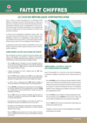
Le CICR est actif en République centrafricaine depuis 1983 ; avec une présence permanente depuis 2007. À ce jour, il dispose d’une délégation à Bangui, de sous-délégations à Kaga Bandoro, Bam-bari et Ndélé et d’un bureau à Birao. Le CICR opère également dans l’...
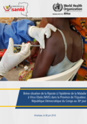
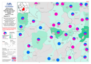
Avec une population estimée à 1 626 606 habitants et une densité de 16 habitants/km2, elle a pour chef-lieu Mbandaka qui est la plus grande ville. L'Équateur est depuis 2015 l’une des 26 provinces de la République démocratique du Congo (RDC).
Les localités de Wangata, Iboko et Bikoro son...

A Guideline for Healthcare Professionals From the American Heart Association/American Stroke Association
AHA/ASA Guideline
DOI: 10.1161/STR.0000000000000158
Updated 23 March 2020 (23 uMatshi 2020)
This handbook reflects and updates the work that ECLAC has done in recent decades to establish a methodology for estimating the economic consequences of a disaster, and thus determine the financing required to rebuild and return the affected area to normal. The handbook's third edition strengthens p...
Accessed 1 July 2014
Children in Kabwe are especially at risk because they are more likely to ingest lead dust when playing in the soil, their brains and bodies are still developing, and they absorb four to five times as much lead as adults. The consequences for children who are exposed to high levels of lead and are no...

Accessed 7 July 2015
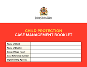
The booklet includes a number of child protection case management forms to be used in tandem with the Training Manual and Framework.
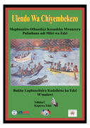
Maphunziro Othandiza Kusankha Mwanzeru Polimbana ndi Mliri wa Edzi. Bukhu Lophunzitsira Kudzilet sa ku Edzi M’malawi
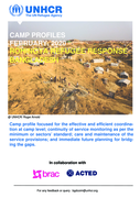
Camp profile focused for the effective and efficient coordination
at camp level; continuity of service monitoring as per the
minimum or sectors’ standard; care and maintenance of the
service provisions; and immediate future planning for bridging
the gaps.